Woods Creek Trail
Woods Creek Trail is a convenient, mostly flat pathway along serene Woods Creek in Lexington. This hike goes through VMI, W&L University and the City of Lexington following the slow-moving Woods Creek though a playground, under tall trees, and through an old railroad tunnel.
Distance: 1.8 miles (One Way)
Drive Time: 1.1 miles/5 minutes*
Difficulty: Easy
Coordinates: 37.79205996401522, -79.4292204564924
Hike Time: 1 hour
Views: Developed
* from Lexington Visitor Center, 106 E. Washington St.
DIRECTIONS
Jordans Point Parking—From the Visitor Center, turn right onto East Jefferson Street. At the second light, turn right and proceed 0.8 miles to North Main Street and bear to the left. If you cross the bridge, you have gone too far. Proceed 0.1 mile and turn left onto Moses Mill Road. Park at the pavilion on the right.
Woods Creek Parking
From the Lexington Visitors Center, turn right onto East Washington Street and proceed 0.2 miles to Lee Avenue. Turn left and continue to the light and turn right onto West Nelson Street. Proceed 0.1 mile and turn left onto Mclaughin Street. Continue 0.5 miles to Woods Creek Park. It is on the right. Turn right for the parking lot.
TRAIL DESCRIPTION
This trail description begins near Jordans Point. From the parking area, cross Stono Road. The trail begins on a sidewalk next to the Miller House Museum. On the right there is a sign for the Woods Creek Trail. It begins with an easy climb to a right switchback. After the switchback there are three more switchbacks. The grade becomes more moderate.
At the top of the climb the Wood Creek Trail follows a gravel road. It passes VMI practice fields on the left and the VMI Firing Range on the right. It continues at an easy grade. Take the left fork and begin a short easy drop to a paved road. The trail crosses the road and goes past the VMI baseball field on the left. Next it passes a concrete railroad marker “BF 20”. This is a reference to the distance to Balcony Falls. Just past the marker are three rocks across the trail. This marks the end of the Woods Creek Trail on the VMI Post. The distance is 0.9 miles
At East Denny Circle, the trail turns left and makes a quick drop down to Woods Creek. It is now more of a gravel path and passes under a stand of old Box elder and sycamore. It bends to the right and makes a short climb to Generals Lane. After crossing the lane and drops back down to Woods Creek. The creek is on the left. There are some big sycamores and Box elder between the trail and the creek.
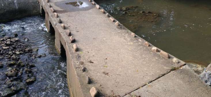
The trail approaches Woods Creek and makes a sharp right turn into a railroad tunnel. The date 1874 is carved on one of the rocks in the tunnel. On the other side it bends to the left. A short distance later it crosses Woods Creek via a concrete bridge. A set of stairs on the left leads to East Denny Circle. It crosses under US 60 and crosses the creek on another concrete bridge. This bridge was built in 2007 as an Eagle Scout project. The distance from the trailhead is 1.4 miles
The path is now mulch covered and the creek is again on the left, while passing under a stand of mid-sized White pine. There is a brief climb up to Lime Kiln Road. The trail crosses the road, turns left and then turns right into Woods Creek Park. The distance is 1.7 miles. Here is another parking area.
At the end of the park, it turns right and drops back down to Woods Creek. The grade continues to be easy. The path is sometimes gravel and sometimes pavement. It passes a big elm, a few big sycamore trees, and three Red cedars before coming to the junction with Jordan Street. It crosses Jordan Street. Waddell Elementary School is on the left. Near the end of the hike, it does a half loop around a big Bald cypress.
After the cypress there is a bend to the left and the Woods Creek Trail makes an easy climb away from Woods Creek. There is a display board discussing the Woods Creek stream restoration project. At the footbridge, the trail crosses the tributary and does an “S” just before climbing a set of steps leading to Ross Road and the end of the hike.
TIPS
- Dogs should be leashed.
- Carry a flashlight if walking at dusk.
- Do not cross low water bridges that are under water.
INSIDER'S TIPS
- Plan to stop along the trail for lunch at Beam Me Up BBQ. It’s near the end of the trail at Lime Kiln Road.
- If you’re not ready to eat, take your lunch “to go” and carry it back to the picnic area at Jordan’s Point Park.
- Treat yourself to an indulgence after your walk. A scoop of homemade ice cream at Sweet Things on Washington Street should do the trick.